 10 hours ago
4
10 hours ago
4
Upgrade to High-Speed Internet for only ₱1499/month!
Enjoy up to 100 Mbps fiber broadband, perfect for browsing, streaming, and gaming.
Visit Suniway.ph to learn
Tropical Depression Emong (international name: Co-may) has exited the Philippine Area of Responsibility (PAR), prompting the state weather bureau to lift all tropical cyclone wind signals as of Saturday morning, July 26.
In its 11 a.m. bulletin, the Philippine Atmospheric, Geophysical and Astronomical Services Administration (PAGASA) said “Emong has officially exited” the PAR.
As of 10 a.m., the center of “Emong” was located 695 kilometers northeast of Itbayat, Batanes (25.7°N, 126.0°E), now outside PAR. It was packing maximum sustained winds of 55 kilometers per hour (km/h) and gusts of up to 70 km/h while moving north-northeast at 35 km/h toward the East China Sea.
Areas affected by strong monsoon winds
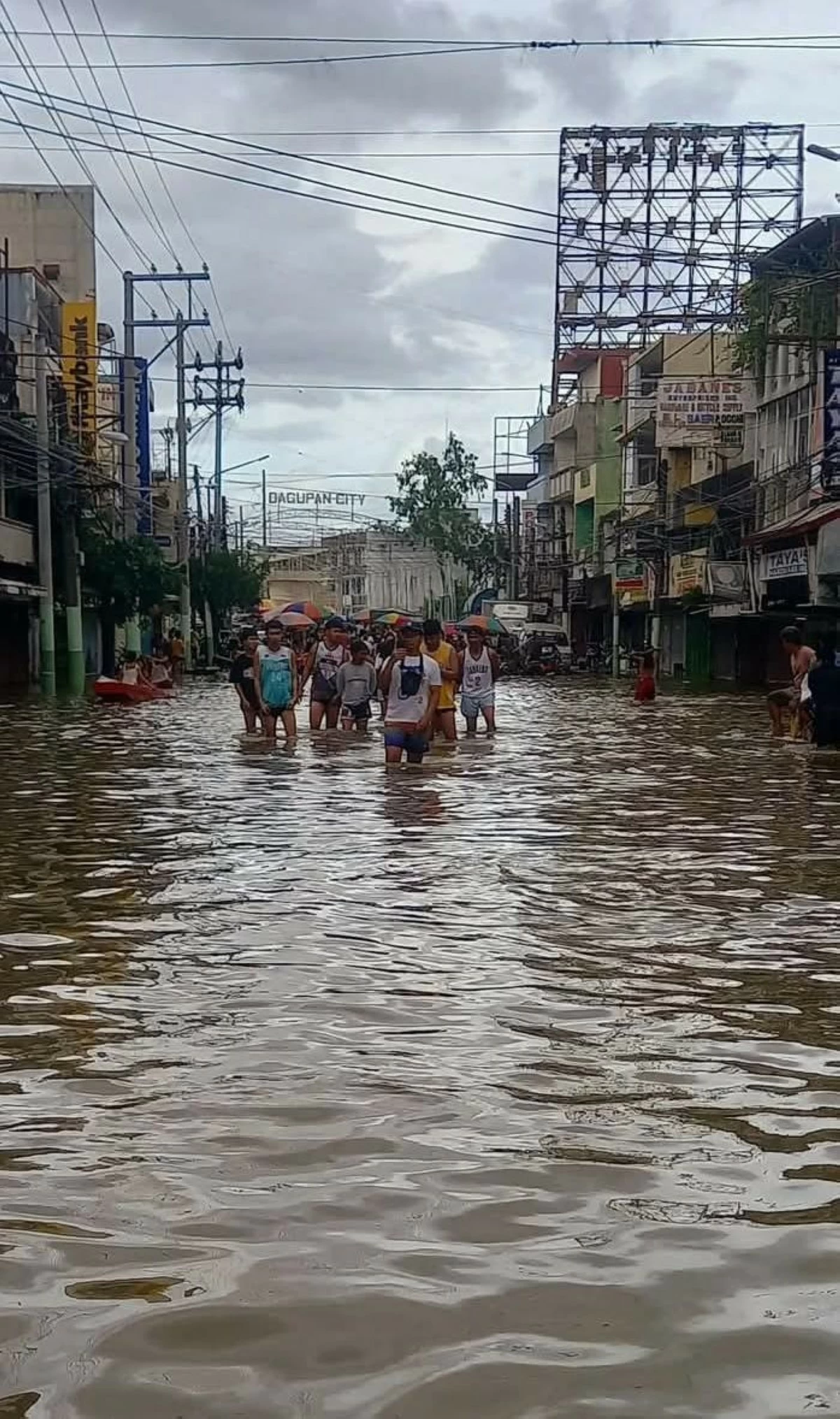
While all Tropical Cyclone Wind Signals (TCWS) have been lifted, PAGASA warned that the enhanced southwest monsoon (habagat) will continue to bring strong to gale-force winds and scattered heavy rains across large parts of Luzon and the Visayas in the coming days.
Gusty conditions are expected in Batanes, Babuyan Islands, Ilocos Region, Cordillera, Central Luzon, Metro Manila, CALABARZON, MIMAROPA, Bicol Region, Northern Samar, Western Visayas, Negros Occidental, and Davao Oriental (July 26).
By Sunday, July 27, and Monday, July 28, PAGASA said winds will persist or intensify in Isabela, Nueva Vizcaya, Quirino, Aurora, Zambales, Bataan, Bulacan, Rizal, Quezon, Cavite, Batangas, Occidental Mindoro, Palawan, Romblon, and Samar provinces.
Hazardous sea conditions
PAGASA said rough to very rough seas, with wave heights reaching up to 4.0 meters, are expected along the seaboards of Batanes, Babuyan Islands, and northern Ilocos Norte.
Moderate to rough seas (up to 3.0 meters) are forecast in Cagayan, Isabela, and the western seaboards of several Luzon provinces.
Small boats and inexperienced mariners are strongly advised to avoid sailing in these areas. PAGASA urged all vessel operators to take precautionary measures as sea travel remains risky, especially for smaller crafts.
‘Emong’ weakening outside PAR
PAGASA said “Emong” is likely to weaken into a remnant low over the East China Sea within the day and is no longer expected to re-enter PAR.
Communities in high-risk and flood-prone areas, however, were advised to remain alert and follow directives from local disaster risk reduction and management (DRRM) offices.
PAGASA also advised the public to monitor rainfall and thunderstorm advisories from their respective regional services divisions.