Upgrade to High-Speed Internet for only ₱1499/month!
Enjoy up to 100 Mbps fiber broadband, perfect for browsing, streaming, and gaming.
Visit Suniway.ph to learn
EJ Macababbad - The Philippine Star
December 26, 2025 | 12:00am
MANILA, Philippines — Set to receive fresh and substantial funding from the government, the team behind Project NOAH plans to enhance its hazard maps to include multiple flood analyses for improved planning.
The bicameral conference committee earmarked P1 billion for Project NOAH, which stands for Nationwide Operational Assessment of Hazards, sourced from the P255-billion cut in the budget of the Department of Public Works and Highways (DPWH).
The funding is placed under the University of the Philippines Resilience Institute (UPRI), which absorbed the project in June 2017.
House appropriations committee chair Rep. Mikaela Suansing said the UPRI will work closely with the DPWH to “refine” ways of designing and monitoring flood control projects.
The government’s newly launched flood mitigation program, Oplan Kontra Baha, will be guided by studies from Project NOAH to identify areas outside Metro Manila that also need flood control measures.
UPRI executive director Mahar Lagmay said that besides lending expertise for Oplan Kontra Baha, the P1 billion will fund overdue updates for its vaunted hazard maps, which currently only use 30 years of rainfall data from the state weather bureau.
The maps do not show flood, landslide and storm surge hazard levels when cyclones deliver a 25-, 50- or 100-year flood return.
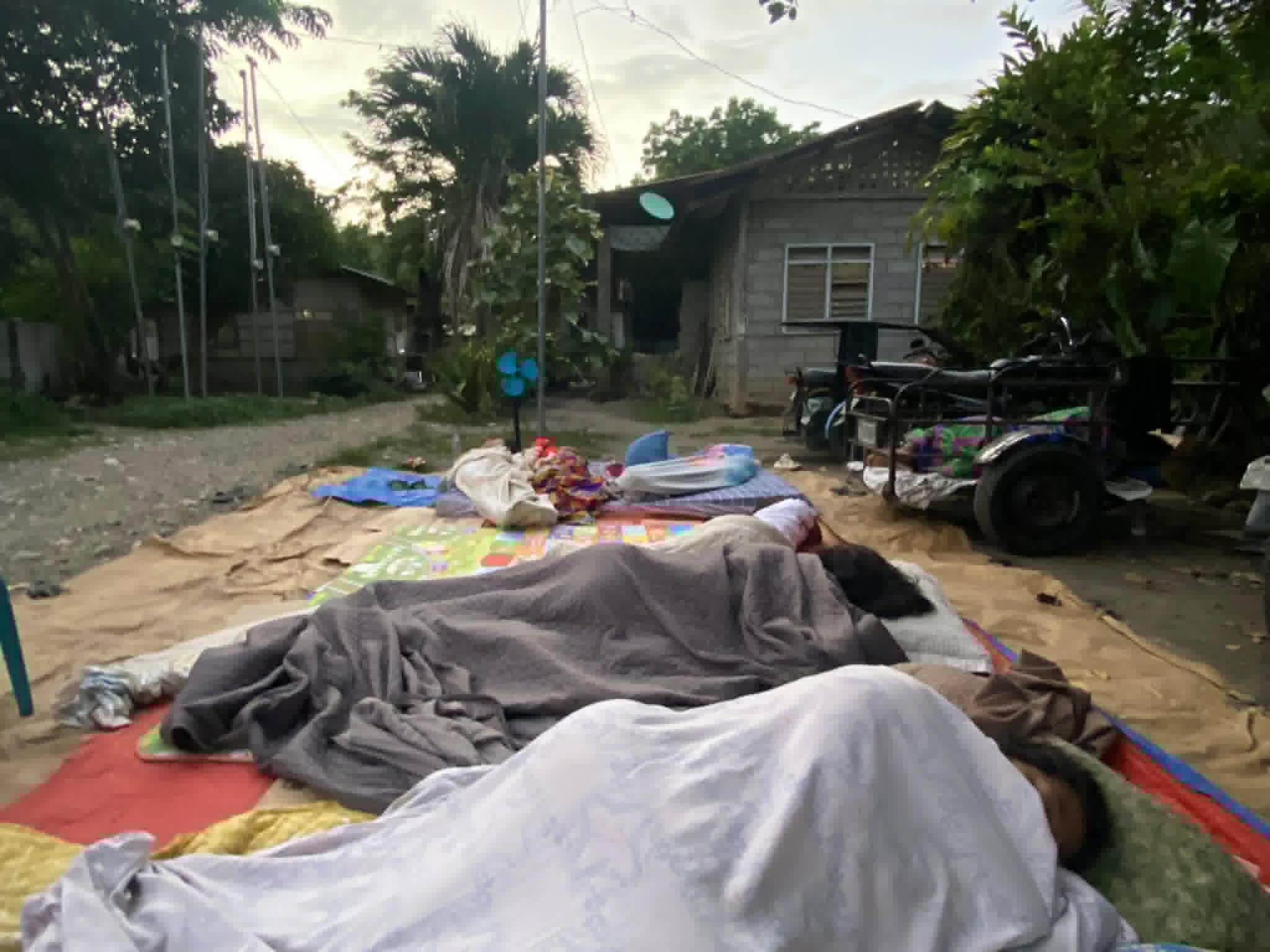
Current floodwaters in Metro Manila already have a 100-year return period, which, in the past, would have only occurred once in a century.
This is evident in cyclones such as Typhoon Carina in 2024 and Typhoon Ulysses in 2020, as well as the onslaught of the southwest monsoon in 2012 and 2018, as seen by the Marikina River rising by double digits, equivalent to a three-story building.
By incorporating multiple scenarios into hazard maps, the government can be better prepared and informed for future cyclones.
“You can anticipate more and you won’t underestimate the disaster,” Lagmay said.
“You have a legal basis for budgeting in the government because you know the risk that’s involved… you incorporate climate projections and you have risk-based decision frameworks,” he added.
Public Works Secretary Vince Dizon admitted in October that many existing flood control projects were ill-planned and exacerbated flooding instead of reducing it.
Since the 2018 General Appropriations Act, the government is mandated under the law’s general provisions to subject all national projects to multi-scenario, probabilistic analysis, with the Climate Change Commission (CCC) coordinating with agencies on risk assessment and climate change adaptation and mitigation planning.
UPRI provides data and technical support to the CCC on science-based risk and vulnerability assessments and disaster risk management.
Flood works built before the corruption scandal erupted are only capable of handling floodwaters with a 25-year return period, which Lagmay considers “not worth the investment.”
“What we’re currently using to plan communities is exactly the opposite: they are single-scenario deterministic susceptibility maps,” the UPRI chief said. “With a multi-scenario analysis, you know what to expect.”
Negros Occidental Rep. Javi Benitez said over 2.5 million Filipinos access Project NOAH’s hazard maps on its website during peak times daily.
Making do
with a small budget
Lagmay handled six of the 19 components under Project NOAH: ClimateX, Hydromet Sensors Development, Disaster Risk and Exposure Assessment for Mitigation, Storm Surge Inundation Mapping and WebGIS Disaster Management.
Together, they cost up to P400 million of Project NOAH’s total P6.4-billion funding over five years under the Department of Science and Technology (DOST).
Since the project’s transfer to UP, it has operated with just an annual budget of P36 million, according to Suansing.
Lagmay said in September that since the transfer, Project NOAH’s endeavors have mostly been local, with partners here and abroad providing funding.
“It would be preferable to restore our nationwide operations because what we do is vital for communities planning for hazards and climate change impacts,” he told The STAR’s “Truth on the Line.”
Just 60 percent of the hazard maps were completed when the DOST pulled the plug in February 2017.
Lagmay said the fresh funds from next year’s budget will enable Project NOAH to acquire new technologies, which will benefit more people as the country faces constant disaster threats.