 1 day ago
7
1 day ago
7

Upgrade to High-Speed Internet for only ₱1499/month!
Enjoy up to 100 Mbps fiber broadband, perfect for browsing, streaming, and gaming.
Visit Suniway.ph to learn
Already have Rappler+?
to listen to groundbreaking journalism.
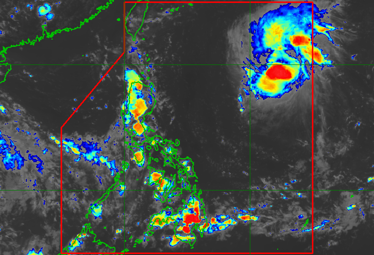
QUEENIE. Satellite image of Tropical Storm Queenie (Surigae) as of September 24, 2026, 4 pm.
PAGASA
While Tropical Storm Queenie (Surigae) won't directly affect the Philippines, its trough or extension could trigger scattered rain and thunderstorms
MANILA, Philippines – Tropical Storm Queenie (Surigae) is expected to remain far from land and will not have a direct effect on any part of the Philippines, although its trough or extension is causing some rain in portions of the country.
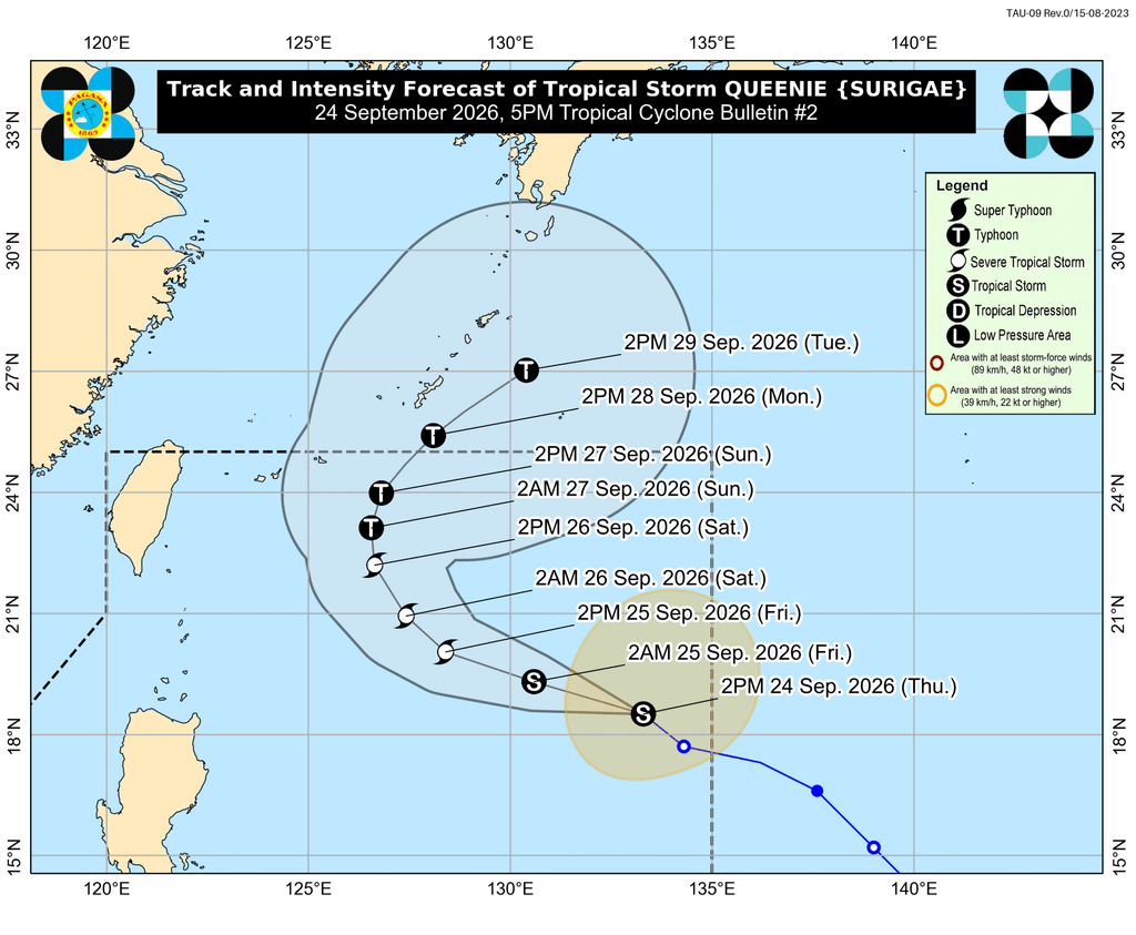
The tropical storm had entered the Philippine Area of Responsibility (PAR) at 7 am on Thursday, September 24. It is the country’s 17th tropical cyclone for 2026, and the first for September.
As of 4 pm, Queenie was located 1,205 kilometers east of Northern Luzon, moving northwest at 25 kilometers per hour (km/h).
So far, it still has maximum sustained winds of 75 km/h and gustiness of up to 90 km/h. But it may intensify into a severe tropical storm on Friday, September 25, and into a typhoon by Sunday, September 27.
The Philippine Atmospheric, Geophysical, and Astronomical Services Administration (PAGASA) expects Queenie to generally move west northwest until Friday, before turning north northeast by Sunday. Its exit from PAR could happen by Monday morning or early afternoon, September 28.
While Queenie won’t directly affect the country, its trough or extension could trigger scattered rain and thunderstorms in Mindanao, the Negros Island Region, Aklan, Iloilo, Guimaras, and Siquijor, as well as isolated rain showers or thunderstorms in the rest of the Visayas and Bicol, on Thursday evening.
Strong to gale-force gusts may also hit Davao Oriental, Davao Occidental, and Sarangani in the next two days, still due to the trough of the tropical storm.
Other parts of the country have generally fair weather, with just localized thunderstorms.
The southwest monsoon or habagat is already winding down. The transition period to the northeast monsoon or amihan could start within the next couple of weeks, according to PAGASA Weather Specialist John Manalo. – Rappler.com
How does this make you feel?
Loading